Wednesday, February 25, 2015

New Zealand's Air Mass, Global Winds and Rain

1. Their main air mass is Maritime Tropical. 
2. New Zealand gets hit by prevailing south westerly winds. 
3. Orographic rainfall is the most common in New Zealand because on the west coast of the South Island the air masses are forced up and over the mountain ranges which makes the clouds cool and start to condense at the top of the mountains, this causes the leeward side of the mountain to be really dry.

Monday, February 23, 2015

Introduction to Weather and Climate Questions

1. The sun radiates eat the warms the earth.
2. They receive more direct sunlight throughout a calendar year which keeps it warmer than polar regions.
3. Albedo is the fraction of radiation that reflects back into space. The black roof would absorb more radiation since it has a lower level of albedo.
4. Lapse rate is the rate of atmospheric temperature decrease when altitude increases. 
5. Aspect is the compass direction facing a slope. The direction a slope faces can affect biotic and physical features. Plants would grow better on the south side facing side of a mountain in the northern hemisphere. 
6. Since the Earth is tilted on its axis going around the sun, certain hemispheres get more sun at one time of the year than others. 
7. Land heats up faster because the heat gets absorbed in the surface unlike water which has different physical properties and has to heat all the way through which takes longer. 
8. The climate is a lot drier and certain plants can't grow their because of the lack of water, but helps plants like wheat grow really well since they don't need a lot of water.
9. It keeps Norway's coastal water from freezing over with its strong winds even though Norway is close to the arctic. 
10. The Alaska current runs past BC.
11. Adding carbon dioxide impacts the atmosphere by heating up the temperature which helps advance global warming.
12. Convection is the collective, concerted movement of a group of molecules within fluids and rheids, usually through diffusion or advection or even a combination of both.
13. Wind is the natural movement of the air, mostly in the form of a current of air blowing in one direction.
14. An urban heat island is an area that is significantly warmer than its surrounding rural areas and it is caused by human activities and can mainly be noticed when the winds are weak in the area. It is mainly caused when the modification of land surfaces use materials that impact the storing of sort-wave radiation. 

5 Themes Assignment

Part A: 

Movement- This picture shows movement because trains throughout our history have transported food and other supplies across countries and have brought countries together by taking people from one side to the other.

Location- The Eiffel Tower is shown in this picture, its absolute location is 48.8582 N and 2.2945 E. The relative location is that it is located on the Champ de Mars in Paris and near a river.

Place- In this picture is an iceberg, there would be icebergs no matter what making it a physical place, but with humans causing pollution and global warming they're melting and disappearing. 

Part B: New Zealand

         Location:

                  Absolute- Wellington, New Zealand's capital is at 41.2889 S and 174.7772 E.

                  Relative- Wellington is located in the South Pacific Ocean, Southeast of Australia and is surrounded by the Tasman Sea and Pacific Ocean.
         Place:

                  Human- The Sky Tower, Schools and other buildings/homes.

                  Physical- The many lakes, Mount Tarawera and Fox Glacier.

         Movement- Planes, cars and trains to transport goods and people in New Zealand. Computers and phones to help people communicate. Boats and water all around the country and its many islands also transport goods and people around the country.

         Region- New Zealand is located in Oceania and has 16 regions in the country Northland, Auckland, Waikato, Bay of Plenty, Gisborne, Hawke's Bay, Taranaki, Manawatu-Wanganui, Wellington, Tasman, Nelson, Marlborough, West Coast, Canterbury, Otago and Southland.

         Human and Environment Interaction:

                   Modify- They've had to modify lots of the cooling/heating devices in homes and buildings since the climate can get really warm, but also get cold fronts at times.

                   Adapt- People have adapted to the lush jungle islands and warm climates by living close to water and dressing warmer most of the time.

                   Depend- They depend on the tons of water resources throughout and around the islands and on all the animals and plants on the islands and in the water for food and the water for transportation from island to island.


Friday, February 13, 2015

Lake Taupō Landslide May.7,1846.

On May.7,1846, there was an unusual rainy season which caused a large land slip on Mount Kākaramea. The land slip dammed a stream and after three days it burst its barriers and with tons of force swept rocks, trees and earth into Lake Taupō. The village Te Rapa got buried and only a few people were able to flee, 60 people in total were killed. Waihī is a village built near the site, but in March.20,1910, a similar event happened causin only one person to die. After what sounded like cannon fire villagers ran outside to see a cloud of dust fade away and reveal another enormous landslide had came down the valley. In the first land slide the south-western shore of Lake Taupō was destroyed.

The Hydrosphere is involved by the lakes shore being destroyed and the stream being dammed, as well as the rain affecting the land.

The Lithosphere is involved by the rocks being swept down the valley and the land sliding causing destruction and burying a village. 

The Atmosphere is involved by creating a cooler climate causing the unusual rainy season.

The Biosphere is involved by the trees being swept down the valley and the people being affected and killed, as well as the animals homes being destroyed.

Wednesday, February 11, 2015

Information on New Zealand

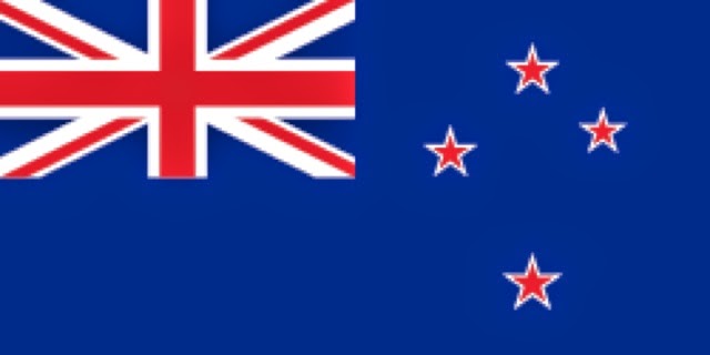
1. 
2. Located in Oceania within the Realm of New Zealand.
3. Wellington is the capital city.
4. 268,021 km2 size.
5. 4,509,900 population.
6. Unitary Parliamentary Constitutional Monarchy type of government.